 |
 |
 |
 |
 |
 |
 |
 |
 |
 |
 |
 |
 |
 |
 |
 |
 |
 |
 |
 |
 Previous Page

032117_YKMV_A11.pdf

West-Hodson Lumber and Concrete

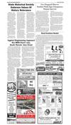
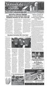
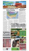
Local Farmers Uses Modern Technology to Improve Crop Yields and Quality
shop online at www.missourivalleyshopper.com
March 21, 2017 • Page 11
National
Ag Week
March 19-25, 2017
Thank A Farmer Today!
Local Farmer Uses Modern Technology to Improve Crop Yields and Quality
By Loretta Sorensen
Just about every yield advantage for corn and soybeans has been identified, except those that may only
be observable from an aerial point of view.
That potential for incrementally improving crop yield
and quality is what motivates Mission Hill farmer Chris
Nelsen to make use of drone technology.
After buying his first drone four years ago, Nelsen
has learned that a bird’s eye view can reveal important
information about his crops and irrigation systems that
give him an advantage for his bottom line.
“Once a corn crop is four to five feet tall, there are
a lot of things you can’t see just by looking across the
field,” Nelsen says. “You could have insects attacking
the crop, nutritional deficiencies in different areas of the
field or maybe some flooding problems. You won’t be
able to address those problems unless you have a way
to identify them. Drones can help wit that.”
Drone use in agriculture has evolved as operators
like Nelsen have learned how to use them and drone
technology has advanced. What started as a quick way
to view a crop is now giving farmers an opportunity to
obtain GPS coordinates for their entire field to create
a map that can be overlaid on a yield map to reveal a
higher degree of information about the crop.
“The Cadillac of drones starts uploading data even
as its flying over a field,” Nelsen says. “There are third
party vendors who can take drone images and stitch
them together to create a panoramic view of the crop.
Add the geo reference data to that and you have a lot of
information about your crop and your field.”
Infrared photography is one of the emerging features
of drones used in agriculture. Infrared photography can
be used to help assess a plant’s health. Traditionally,
infrared imagery for agricultural and ecological use
has been captured from satellites and airplanes. The
information it provides has been used mainly by large
farming operations and academic research projects.
However, farmers like Nelsen can now use drones
to capture infrared images of crops and review the
pictures to determine if plants are suffering from issues
such as nitrogen deficiency or overwatering.
“Infrared images will provide a comparison of how
‘green’ each plant is,” Nelsen says. “The greener the
plant, the healthier it is. Nitrogen deficiency is a common plant health issue. However, something like a
plugged or worn irrigation sprinkler package could be
causing either excess or lack of water in an isolated
area. Drones that capture infrared images at any time
the farmer needs them can help in recognizing an issue
and responding to it as soon as possible.”
Infrared images of an operating irrigation sprinkler
will reveal differences in the concentric circles created
by the water, pinpointing an irrigation malfunction.
“In the past, we had to rely on satellites to obtain
these types of images,” Nelsen says. “If it happens to be
cloudy on the day you need an image, you might have to
wait at least three or four days for that satellite to pass
over again. Drones can be launched anytime there’s a
need.”
Nelsen has found that ponding issues that don’t appear to be too serious when observed from the ground
level can look much different from an aerial point of
view. The drone can reveal the length and breadth of the
ponding area as well as help in assessing the health of
plants in that area.
“If you use a $20,000 drone, you can have video and
images to review as soon as the drone lands,” Nelsen
says. “I don’t use one with those features, but I am able
to view real time video on my phone or other digital
device by using a drone app. You can view near infrared
video, too.”
Farmers like Nelsen who have implemented drone
technology in their operations are finding that they have
a wealth of data they don’t always know how to use.
Partnering with an agronomist or other crop and soil
specialists can help in mining the information drones
gather.
“You want to use that information to the best of your
ability to maximize efficiency and productivity,” Nelsen
says. “By putting the trained eyes of specialists like an
entomologist on your information you may discover
things you wouldn’t otherwise recognize.”
Nelsen cautions that use of drones doesn’t relieve
farmers of the need to physically scout their fields and
get close to the crop. All the images and video in the
world can’t replace that hands-on observation.
“You can’t just farm from the sky,” Nelsen says. “You
have to get out there. Just flying over a field with a
drone isn’t going to make everything okay.”
To select an appropriate drone, Nelsen recommends
completing research to learn about the features of
different types of drones and ask agricultural experts
and those engaged in the agriculture industry for their
insight on the topic.
“There are companies who have all the technical information and know all about designing and servicing a
drone, but they may not be able to help farmers understand the benefits of stitching crop images together or
even help them find a vendor to provide that service,”
Nelsen says. “Take time to weed out the drone companies that aren’t equipped to specifically help you make
the most of your drone.”
The normalized difference vegetation index (NDVI) is
a simple graphical indicator that can be used to analyze
remote sensing measurements to assess whether or not
the observed target contains live green vegetation.
NDVI maps show the difference between the nearinfrared (strongly reflected by vegetation) and red light
(which is absorbed by vegetation). The maps can be
created by drones that
capture near-infrared
and red wavelength data.
The information aids in
•We deliver 6 days a week
activities like monitoring
•Serving Northeast Nebraska since 1930
drought and predicting
•Locally owned and operated state approved
Best Choice...Quality Concrete & Building Materials
•No job too big or too small
yield. It also provides data about density and intensity
of green vegetation growth. Water stressed, diseased or
dead leaves become yellow and reflect significantly less
in the near-infrared range.
“All this information can be used to help develop
prescriptions for variable rate planting, fertilizing and irrigation,” Nelsen says. “It could also be used to develop
spraying plans for insect or weed treatments. Based on
the wave length emitted, you could program a sprayer
to treat anything that varied from the wave length
emitted by a corn plant. All of that precision matters in
making crop production affordable and reliable.”
Nelsen has retained images from the past four years,
storing them on his computer. Cloud storage is usually
an option for drone images. Nelsen doesn’t rule out the
use of other technologies to maximize his potential for
top yield production.
“This past year we used a plane equipped with a high
end camera to review some drainage issues before we
planted to avoid losing nutrients to runoff,” Nelsen says.
“We can use the map generated through that to overlay
and correlate with our yield map to further identify any
shortcomings or faults in specific areas.”
Nelsen believes drone technology will continue gaining favor in the agriculture industry because it extends
the options for farmers to refine crop production and
improve overall yield with data captured from the air.
“Even a 2% or 3% loss is significant for farmers,”
Nelsen says. “Losses can be reduced with tactics like
fertilizer stabilizer to reduce leaching or drone data to
reduce ponding. Incremental gains, especially in years
with low profitability, can make all the difference.”
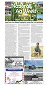
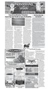
Photo Courtsey of Loretta Sorensen
Mission Hill farmer Chris Nelsen uses modern farming
technology, such as drones, to identify incremental improvements in his crop production that positively impact
his bottom line.
Discover The Uncompromising Colors
of Pratt & Lambert® Paints
87 Years Of Customer Service
www.west-hodson.com
Crofton ..........402-388-4330
Osmond ........402-748-3300
Plainview .......402-582-3866
Norfolk ..........402-374-0201
Bloomfield .....402-582-3866
Johnson Electric, LLP
Rick Merkel • Ben Merkel
Chris Merkel
• Rural • Residential • Commercial
• Electrical & Telephone Wiring
• We Trench H20 Lines, Footing & Electric Lines
• Our Bucket Truck Reaches 80’ PLUS
• We Set Poles
FAST COURTEOUS
SERVICE
500 W. 12th St.
YANKTON
665-5686
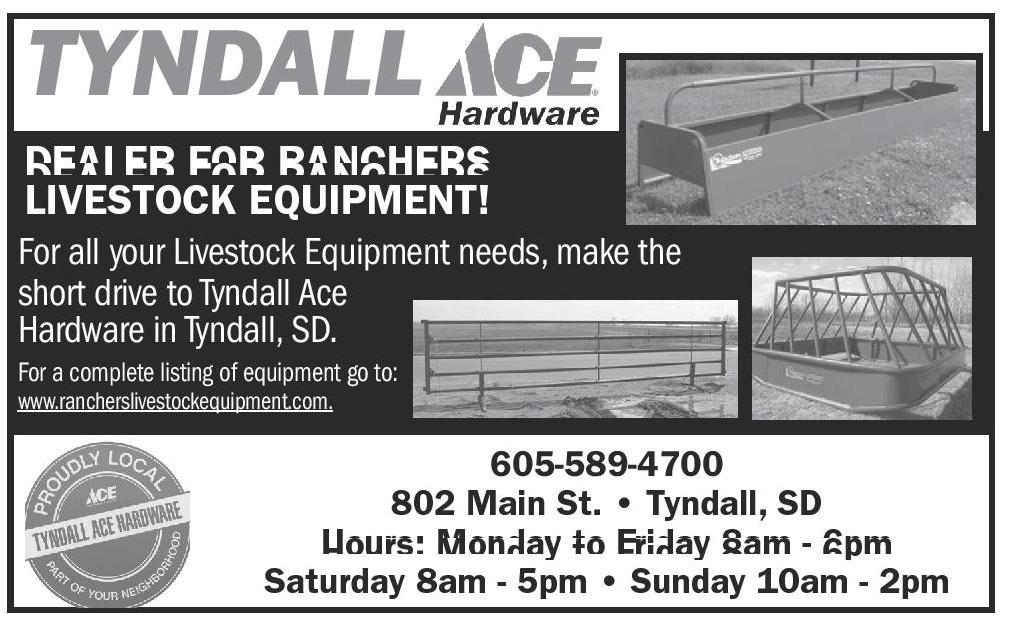
TYNDALL
DEALER FOR RANCHERS
LIVESTOCK EQUIPMENT!
For all your Livestock Equipment needs, make the
short drive to Tyndall Ace
Hardware in Tyndall, SD.
For a complete listing of equipment go to:
www.rancherslivestockequipment.com.
605-589-4700
802 Main St. • Tyndall, SD
Hours: Monday to Friday 8am - 6pm
Saturday 8am - 5pm • Sunday 10am - 2pm